“Unlike anything I ever saw…”
Quite possibly the most fearsome event ever to strike Downriver in modern times, the July 16, 1980 storm that swept eastward from Wisconsin took Downriver and southeastern Michigan by total surprise. In just a few short minutes, according to many witnesses, the sky turned from bright to dark-green, and was one of the most horrifying sights they had ever seen. As quick as it appeared, it disappeared, but left destruction in its wake not seen in this side of the state since at least the 1950s.
NOAA Weather event synopsis
While the sky was relatively bright at sunrise over Southeast Lower Michigan, a band of foreboding clouds advanced in quickly from the west, covering the celestial dome.
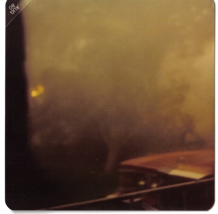
As the forceful storms and associated hurricane force winds approached the area, several observers remarked about the horrid dark green color the sky took on as the squall moved overhead. In fact, numerous people over the years have commented about the “dark pea green sky” that accompanied the July 16th 1980 storm.
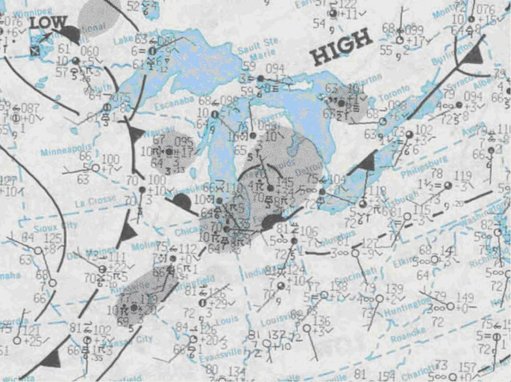
The green color in the sky may have been reflective of the low sun angle at the time (the derecho moved through region between 730 and 930 AM EDT) and abundance of moisture in the low clouds. It got so dark that many street lights were triggered and popped on over portions of the region.
Severe thunderstorm warnings were issued over the region though some remarked: “it happened so quickly and early in the day, it caught us off guard”.
The hardest hit regions across Southeast Lower Michigan were Washtenaw and Wayne counties, extending mainly from the Ann Arbor area east into southern sections of Detroit (or south of the Ford Road /M-153/ corridor).
While the wind officially gusted to 71 mph at Detroit Metro Airport, much higher winds were reported in other areas in the strongest core of the derecho.
Jerry Van’s eyewitness account
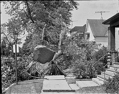
“In a ranch house on Wohlfeil, I was sound asleep with my feet toward the north facing back bedroom window where my brother and I watched the skies glow when 3 Sisters, Great
Scott, Federal’s and Ray Moulder and a tanker or two lit the nights.
“Larry barged into the room, pounced onto the foot of the bed and leaned atop the high-boy dresser under the window. “IT’S GREEN… LOOK, THE SKY IS GREEN, WAKE UP!“
“The next thing I remember is taking this picture (shown above) after he moved dad’s car so he could pull his Cougar up between the houses. The mountain ash was uprooted. A lady knocked on the door some time after asking if we owned a little dog that had blown into her yard.
“Flooding was a major issue around Champaign and Monroe area and dry ice was almost nowhere to be found. Thankfully I was tight with the manager of A&P.” (2014)
Brief NOAA summary of damage
“Railroad cars blown off track in both directions in Allen Park,” most likely along I-94 and Southfield Road.
“Department store roof blown sideways in Lincoln Park,” could very well have been the Sears store at Dix & Southfield.
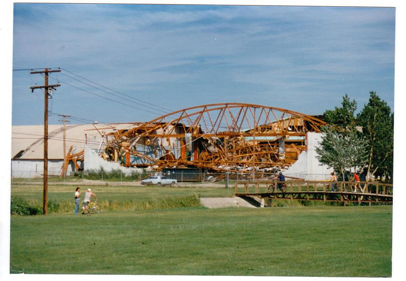
The damage to the arena area at Thunderbowl Lanes in Allen Park, as shown in the top picture. The destruction of the original Ecorse Drive-In Theater in Taylor. Uprooting of nearly two miles of high-voltage power pylons in Lincoln Park and Melvindale, which contributed to a power outage between five and ten days.
“Funnel sighted over Detroit River from Canadian shore. Tornado damage included in, and hardly distinguishable from large area of straight line wind damage. Funnel continued eastward several more miles into Canada”.
A researcher’s version of “irony” was definitely found regarding this particular event… there was scant coverage in the News-Herald of this particular storm. Stories in the Detroit News of July 17, 1980 in fact had more details about the Downriver area than the News-Herald did.
But one may admit that a witness of that event may not have thought it would be just as memorable today as it was in 1980. Our viewers may have known more than the news writers did.
